

ice dam river gauge
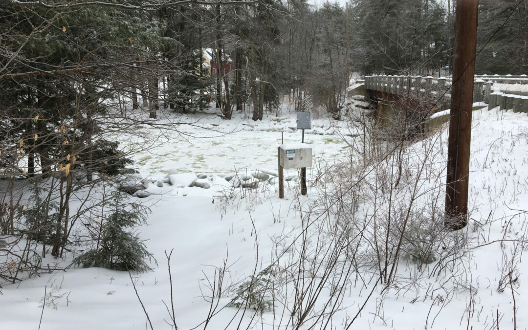
Fragmented ice sheets were transported along the Piscataquog River beginning in late January 2019, resulting in an ice jam extending into the towns of New Boston and Goffstown, New Hampshire. The USGS installed a rapid deployment gauge on the river Feb. 14 to monitor water levels and potential flooding. This photograph shows the permanent USGS streamgage station 01091000, which is upstream from the ice jam and also used to monitor river conditions. Photo: Richard Kiah, USGS
 Return to the Concord Monitor