

Thanks to digital mapping, it’s possible to calculate how grid-like any city’s street layout can be. This story in The Economist explains it:
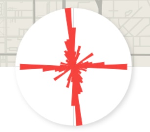
Geoff Boeing of the University of Southern California created a measure of city “entropy”, looking at how consistent the direction of streets in over 100 major cities worldwide is, as well as how continuously they run through any given city without interruption. A measure of zero suggests a city with absolutely no consistent street direction. A measure of one implies a perfect grid, with no interruptions or curves.
I played with the graphic representation of city layouts for some New Hampshire cities and found that Manchester appears to be our grid leader. Its layout looks like this:
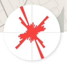
Pretty griddy. Nashua’s pattern reflects its split by the Nashua River running east-west through the middle:
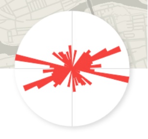
Portsmouth, constrained by all that water is pretty screwy:
As for Concord’s grid – it’s the incoherent splat shown at the top of this article.
 Return to the Concord Monitor
I have no idea what those graphics mean. The “explanation” talks about a number score and those graphics show tomato splats. What are the individual city scores? What do the splats represent?
@ Marc It looks to me that more long streets (thinner stripes) in a cross pattern means more “grid-like” while a big blotchy center (short stripes going every which way) means the opposite. I bet my hometown of Chicago is gridlike; it grew out on a flat plane and all the streets lined up like like graph paper.
Also, “Incoherent Splat” would be a good name for a rock band.