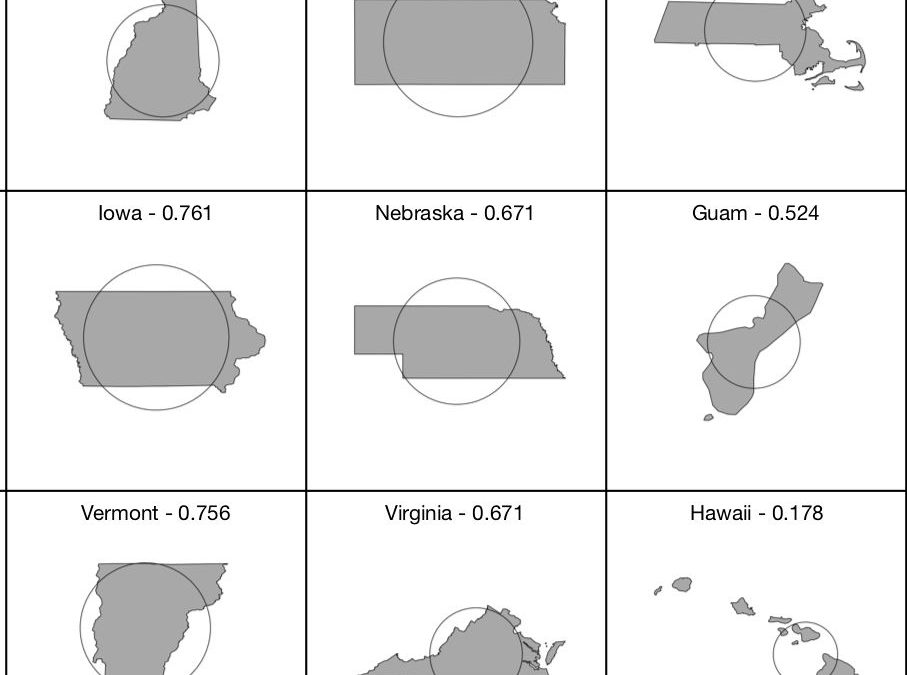
People from other parts of the country, I have found, get Vermont and New Hampshire mixed up because we’re so small. I have several times been asked the equivalent of: “Are you the one that’s big on the top or the one that’s big on the bottom?”
Now I have a new answer: We’re the one that’s eight-tenths of a percent more circular!
Specifically, the ratio of the perimeter and area for New Hampshire produces a value of 0.762 (in which 1 is a circle and 0 a straight line) while Vermont is a mere 0.756. Ha, take that Green Mountain State!
I learned this charming and irrelevant fact from this Reddit post is a subreddit called MapPorn.
According to its calculations, which I haven’t checked, the least circular state or territory that isn’t made up of multiple islands (e.g., Hawaii, Guam) is Massachusetts. That surprised me; I would have voted for the ridiculously shaped Maryland. However, as one comment on the post pointed out, this value varies if you include water borders.
In New England, Maine leads the circularity race by a long shot. Its measure of 0.825 puts it No. 14 on the roundness hit parade.
What does this mean in real terms? Nothing whatsoever, I’m happy to say. These days, I’ll take all the fun stuff that doesn’t have any unpleasant real-world connotations that I can find.


 Return to the Concord Monitor
This makes zero sense. The ratio of the perimeter of a circle to its area is 1? The units aren’t the same, so it doesn’t even make sense to take the ratio. If you run the formulas, it’s 2πr / πr^2, or 2/r. So if you arbitrarily assume r is 2, then you get 1. Or any other number you like.
The ratio of the perimeter to the area of a straight line is 0? That makes even less sense. A straight line is a one-dimensional figure and doesn’t have either perimeter or area.
I’m afraid that whatever the intended point of the article was, it got garbled in the process.
It’s not a ratio, it’s a relative measure.