
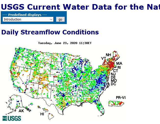
The above map from the USGS streamflow site (waterdata.usgs.gov) tells the story of our dry conditions. Red means a water level lower than 10 percent of recordings for that moment over the past eight decades or so (measurement time scales differ for different sites).
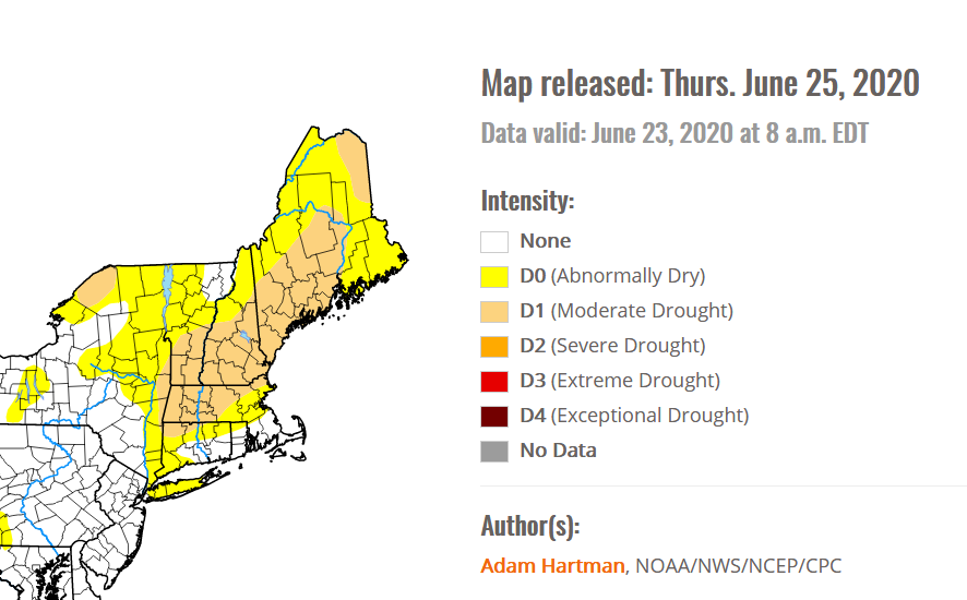
On Thursday, the National Weather Service made it official: We’re in a drought. Concord, for example, had one-fifth of an inch of rain from May 15 to June 15, the lowest on record for that period. The 140-year average is 4 inches.
 Return to the Concord Monitor